The Norman Way

Heritage route in Wexford

Menu

Skip to content
  • Welcome
  • Along the Route
    • Rosslare Harbour
    • Lady’s Island
    • St Iberius’ Church
    • Tacumshane Windmill
    • St Catherine’s Church
    • Sigginstown Castle
    • Ishartmon Church
    • Tomhaggard
    • Ballyhealy Castle
    • Grange Church
    • Kilmore Quay
    • Killag Church
    • Duncormick
    • St Imoge’s Church
    • Coolhull Castle
    • The Bannow Font
    • Bannow
    • The Little Sea
    • Tintern Abbey
    • Saltmills
    • Fethard Castle
    • Baginbun
    • Loftus Hall
    • Slade Harbour
    • Hook Lighthouse
    • St Dubhán’s Church
    • Templetown
    • Duncannon Fort
    • Ballyhack
    • Dunbrody Abbey
    • Kilmokea
    • JFK Arboretum
    • Kennedy Homestead
    • Stokestown Castle
    • St Mary’s Church
  • Stories
    • Rosslare Harbour
    • Lady’s Island
    • St Iberius’ Church
    • Tacumshane Windmill
    • St Catherine’s Church
    • Sigginstown Castle
    • Ishartmon Church
    • Tomhaggard
    • Ballyhealy Castle
    • Grange Church
    • Kilmore Quay
    • Killag Church
    • Duncormick
    • St Imoge’s Church
    • Coolhull Castle
    • The Bannow Font
    • Bannow
    • The Little Sea
    • Tintern Abbey
    • Saltmills
    • Fethard Castle
    • Baginbun
    • Loftus Hall
    • Slade Harbour
    • Hook Lighthouse
    • St Dubhán’s Church
    • Templetown
    • Duncannon Fort
    • Ballyhack
    • Dunbrody Abbey
    • Kilmokea
    • JFK Arboretum
    • Kennedy Homestead
    • Stokestown Castle
    • St Mary’s Church
  • More…
    • Contact
    • Email Newsletter
    • Cycling the Route
    • Further reading
    • Primary Teacher resource
    • The Norman Way on Amazon Alexa
    • Biography of the Norman Way project
    • Useful Links
    • Privacy Policy

Stokestown Castle

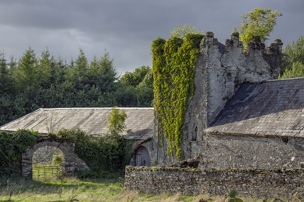
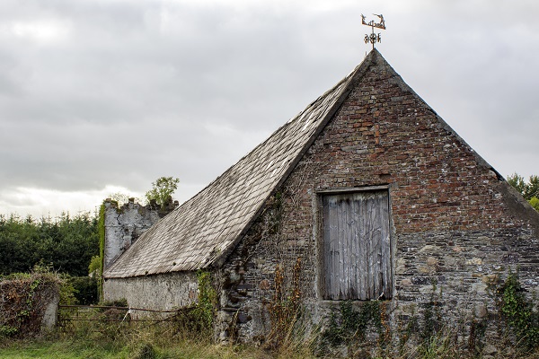
Stokestown Castle is a late medieval tower house that probably dates from the 15th century and is located close to the River Barrow. In the 17th century it was the property of the Dormer family and a watermill and weir were also recorded here at that time.

Changing the Landscape

The Normans cut down large areas of Irish woodland for timber to build houses, ships and mills. They used the newly cleared land to grow large amounts of crops and sold any surplus grain into the growing medieval economy at home and abroad.

Farming in the New Norman Ireland

The Normans divided farmland into strips to be farmed by the tenants of the local lord. These strips were used in rotation as grassland and ploughland for cereal crops. Medieval ploughs were usually pulled by oxen and moved so slowly that it might take a whole day to plough one acre.

The Normans expanded upon the system of crop rotation introduced to Ireland by the Cistercian monks. This farming method involved planting different crops on a patch of land each year to prevent the soil from becoming exhausted.  Certain areas were also left unsown for a year to allow the soil to recover.

Stokestown Castle now lies within a private working farm so please only admire it safely from the roadside.

–
To find
 Stokestown Castle…
Type these coordinates into Google: 52.360542, -6.981307

–

To the West along the Way lies…
St Mary’s Church, New Ross

To the East along the Way lies…  
The Kennedy Homestead

–

Logos banner
Facebooktwitterredditpinterestlinkedinmail
Widgets

Recent Posts

  • St. Iberius’ Church Relic – Saved from Cromwell but Lost for 200 years…
  • The Medieval Church in Tomhaggard
  • The Lost Language of Yola
  • King Arthur’s final resting place…
  • Your Stories from The Norman Way

Recent Comments

    Archives

    • January 2017
    • December 2016
    • November 2016
    • August 2016

    Categories

    • local knowledge

    Meta

    • Log in
    • Entries feed
    • Comments feed
    • WordPress.org
    Proudly powered by WordPress | Theme: Illustratr by WordPress.com.